Israel-Palestine war: Satellite images show 'devastation' of Hamas assault

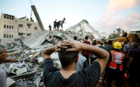
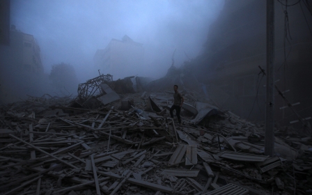
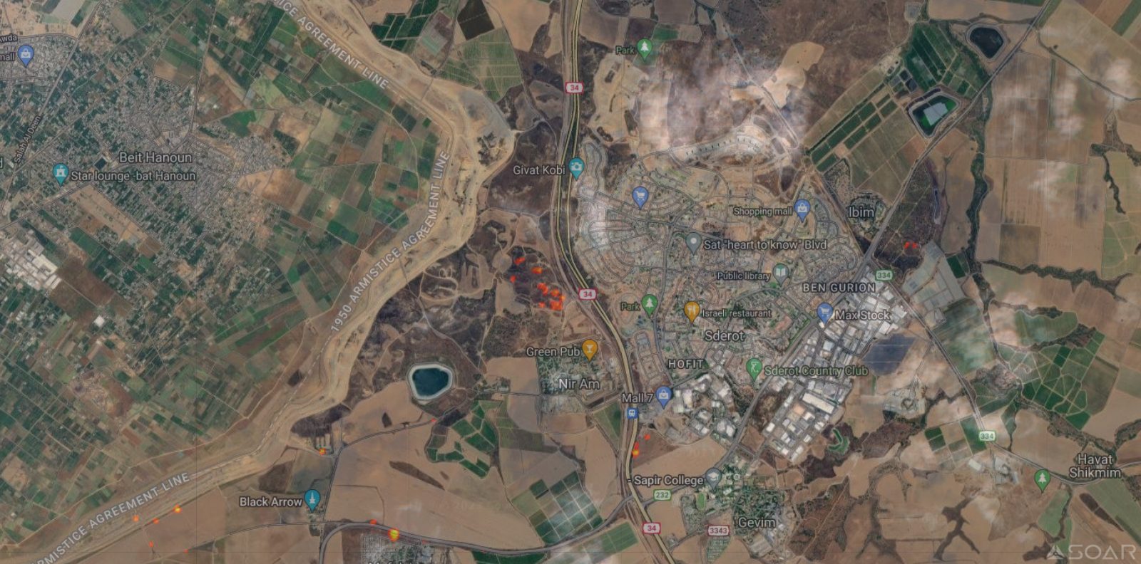
Hours into Hamas’ surprise assault on Saturday morning, dozens of fires burned across southern Israel, new satellite imagery seen by Middle East Eye shows.
Fires can be seen as far north as the city of Yavne, less than a 30-minute drive from Tel Aviv, and within a similar distance to Beersheva in the east.
Several fires rage around an area near the location of the Supernova music festival, where Israeli authorities say at least 260 people were killed by fighters from Gaza, and footage showed others running for their lives.
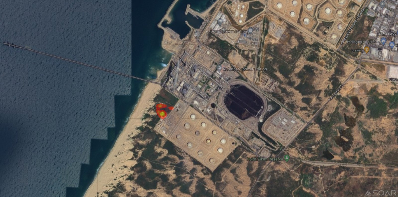
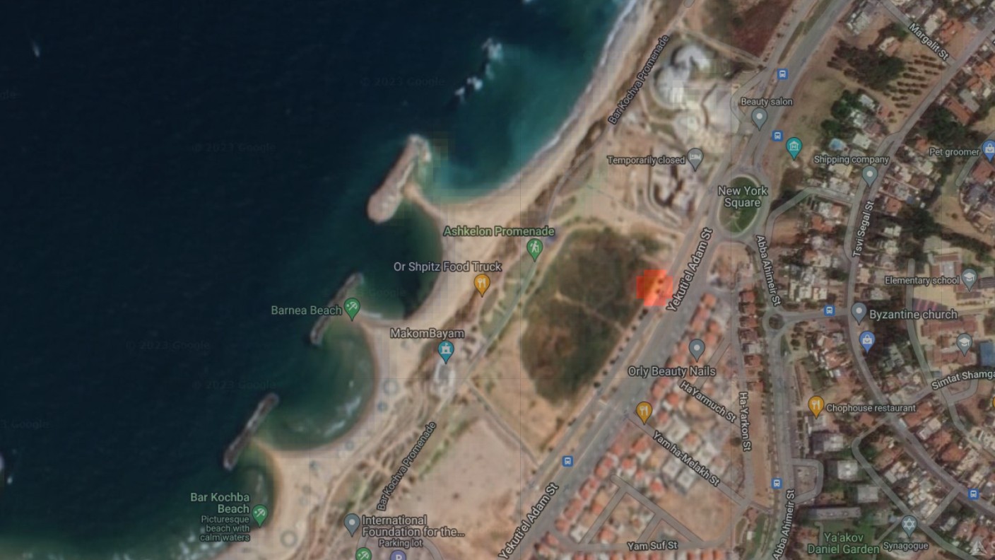
Also on fire are the Rutenberg power station, Israel's second-largest power plant, and apartments and parks in the imagery provided by Soar, which is trying to build an open and free atlas of all of the world's map and satellite images.
“I’m blown away by how much devastation there has been,” Amir Farhand, Soar’s CEO and founder, told MEE on Monday.
New MEE newsletter: Jerusalem Dispatch
Sign up to get the latest insights and analysis on Israel-Palestine, alongside Turkey Unpacked and other MEE newsletters
While revealing, the images are low resolution. Those shown here have been digitally enhanced by Soar with areas where fires were detected highlighted in orange.
Soar analysed the original images to detect heat and then enhanced them to show where and how big the fires are.
![]()
![]()
![]()
![]()
![]()
![]()
Most free satellite imagery of Israel and Palestine is “deliberately downgraded” despite regulatory changes that allow US-based companies like Google to share high-resolution images.
However, in recent years, Soar has become known for sharing high-resolution images of the conflict zone.
“We are the only company as far as we know that releases it publicly,” Farhand said.
“We’re trying to build the biggest atlas of the world so everyone is accountable.”
![]()
![]()
![]()
![]()
![]()
The images were captured just after 10:30am local time, four hours into the campaign, by a European Space Agency satellite which normally flies over the area once every three or four days.
“It was an absolute fluke that this photo was taken at the same time as when this operation was occurring on the ground,” Farhand said.
Farhand and his Soar colleagues said it is hard to tell from the images what caused the fires and why particular locations were targeted.
Smaller fires may have been caused by drones that dropped hand grenades while larger ones, for example, those around the festival near Kibbutz Re'im, may have been started by rockets or men landing in the area and shooting RPGs.
![]()
![]()
![]()
![]()
![]()
![]()
![]()
![]()
![]()
The smoke from the fires seen in the imagery also shows that the wind was blowing strong off the Mediterranean, Farhand said.
"You can tell the wind was coming in by how quickly the smoke dispersed," he said. "They were getting very, very close to Beersheva. That's a long way from Gaza. They would have waited for the right weather conditions."
This article is available in French on Middle East Eye French edition.
Middle East Eye delivers independent and unrivalled coverage and analysis of the Middle East, North Africa and beyond. To learn more about republishing this content and the associated fees, please fill out this form. More about MEE can be found here.