Israel: Netanyahu says map showing Western Sahara as separate from Morocco was mistake

Benjamin Netanyahu's office has said that the Israeli prime minister "mistakenly" displayed a map showing Western Sahara as separate to Morocco during a news conference earlier this week.
Netanyahu showed a map of the Middle East and North Africa region during a press conference on Monday, in which he explained to reporters why he believed Israel must control the Philadelphi Corridor - the buffer zone between the Gaza Strip and Egypt.
The map labelled both Morocco and Western Sahara, sparking a backlash on Moroccan social media. Rabat has claimed sovereignty over the disputed territory since 1975.
"On the 'Atlas' map presented during the Prime Minister's statement today, the name 'Western Sahara' was mistakenly displayed in the territory of Morocco," Netanyahu's office said in a statement published on X.
"It is important to note that on the map in the Prime Minister's office, only Morocco's name appears on the entire specific area.
New MEE newsletter: Jerusalem Dispatch
Sign up to get the latest insights and analysis on Israel-Palestine, alongside Turkey Unpacked and other MEE newsletters
"Israel reaffirms its recognition of Morocco's sovereignty over Western Sahara."
In 2020, Israel recognised Morocco's sovereignty over the region as part of a normalisation between the two countries. The agreement also saw the US recognise Western Sahara as part of Morocco.
Sahrawi nationalists, led by the Polisario Front, fought a war with Morocco between 1975 and 1991 for self-determination in their homeland.
A ceasefire established in 1991 collapsed in 2020. Since then, fighting has resumed mainly along the artificial wall created by Morocco that delineates the areas of the Western Sahara controlled by the kingdom as opposed to those controlled by the Polisario Front.
Previous 'unintended error'
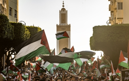
Both Palestinians and Sahrawis have fiercely condemned the deal between Israel and Morocco, saying it undermines the right to self-determination for both groups living in occupied territories.
This week's mistake is not the first time Netanyahu has upset Moroccans over this issue. In May, he was forced to apologise after brandishing a map which did not recognise Rabat's sovereignty over Western Sahara.
"Due to an unintended error, a huge media sensation was created regarding a map used by Mr Benjamin Netanyahu, in which the map of Morocco appears cut off from its desert," an Israeli foreign affairs spokesperson said at the time.
The map shown by Netanyahu on Monday was also widely condemned for excluding the occupied West Bank.
The Palestinian foreign ministry said the use of the map was “a blatant acknowledgment of Israel's colonial and racist agenda".
"The ministry views this as a serious violation of international law, especially as Israel continues its war crimes against Palestinians, aiming to deny their existence and their legitimate national rights," it said.
The Palestinian ambassador to the UK, Husam Zomlot, said Netanyahu’s erasure of the occupied West Bank from the map aimed to erase the Palestinian people and take the rest of their land.
Middle East Eye delivers independent and unrivalled coverage and analysis of the Middle East, North Africa and beyond. To learn more about republishing this content and the associated fees, please fill out this form. More about MEE can be found here.