Rafah: The Sinai-Gaza oasis city divided by a contentious border

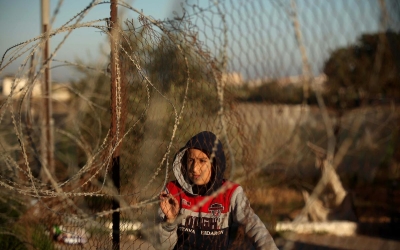
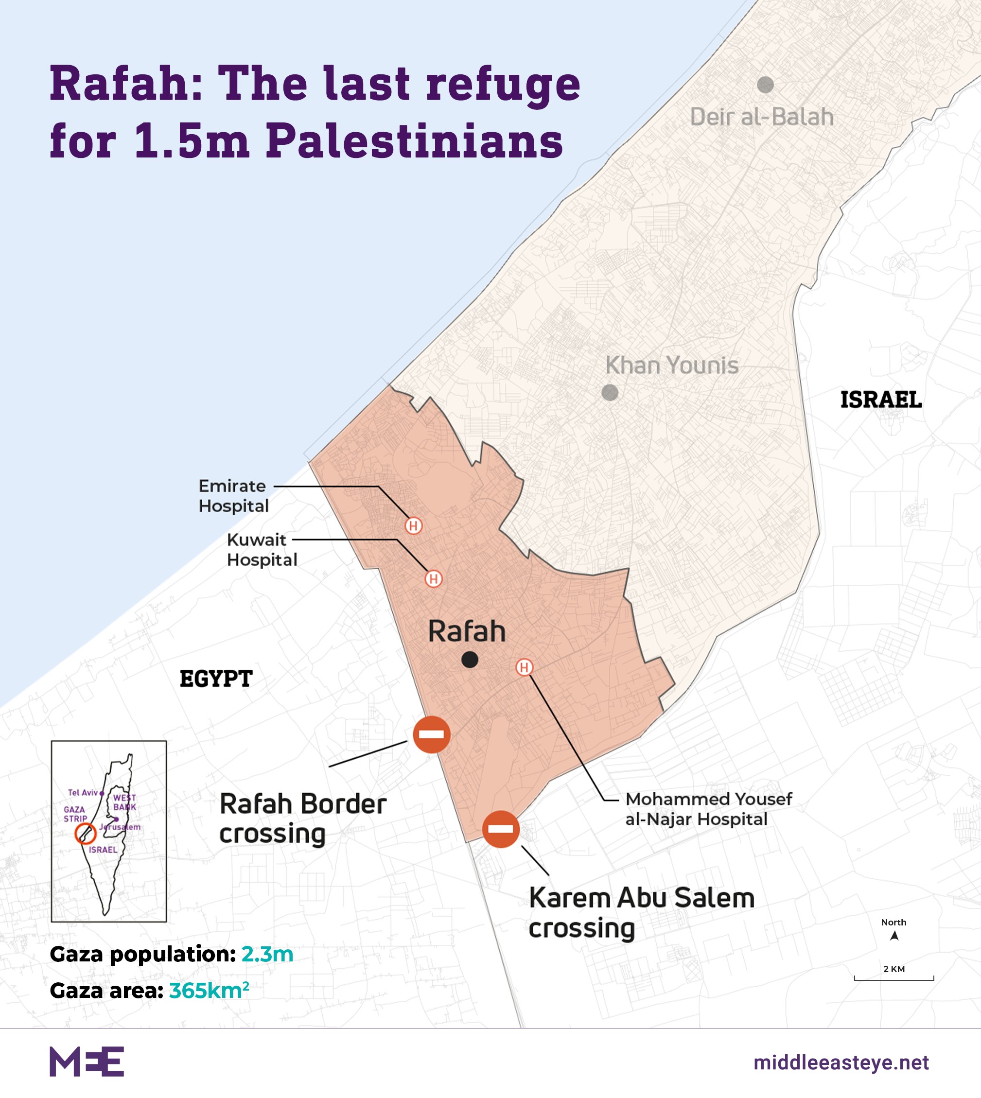
Rafah, the southernmost city in the Gaza Strip, is under siege and constant Israeli attacks.
Before 7 October, the city, which spans just 64 sqkm, was already overpopulated and wracked by poverty and harsh living conditions due to a 17-year Israeli blockade.
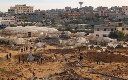
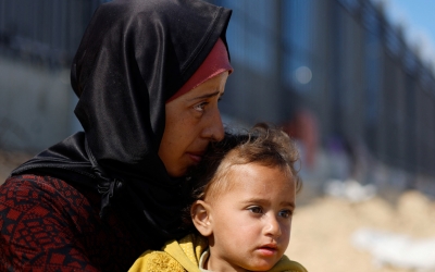
Since then, after Israel forcibly ejected Palestinians from northern and central Gaza towards the south, Rafah's population has quintupled in a matter of months to around 1.5 million.
The people in Rafah, whose history spans three millennia, are now living in what resembles a cramped, makeshift tent city. These temporary abodes are inhabited by Palestinian refugees who have been displaced multiple times in their lives.
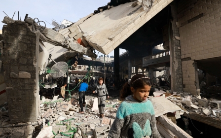
Earlier this week, at least 67 Palestinians were killed after Israeli air forces struck 14 homes and three mosques in the city.
New MEE newsletter: Jerusalem Dispatch
Sign up to get the latest insights and analysis on Israel-Palestine, alongside Turkey Unpacked and other MEE newsletters
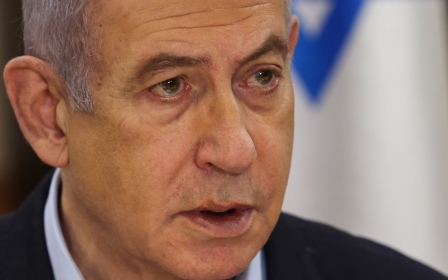
Now, according to Israel's prime minister, Benjamin Netanyahu, it is only a matter of time before Israel launches a ground invasion of the city, despite international protestations.
Middle East Eye takes a look at the history of Rafah, from when it was swapped between various ancient and medieval empires and dynasties, to when a joint British-Ottoman decision began the process of dividing the city into two separate entities.
From oasis to resting station
Rafah is thought to have been inhabited for more than 3,000 years, with its name appearing in ancient Egyptian inscriptions dating back to the 13th century BCE.
It began as a settlement that emerged around an oasis linking the Sinai Peninsula with Gaza. The city was referred to as Robihwa by the ancient Egyptians, Raphia by the Greeks and Romans, Rafiah by the Israelites and Rafah by Arabs.
It was the location of the Battle of Raphia in 217 BCE, one of the biggest battles in ancient history, involving around 150,000 fighters and nearly 200 elephants.
The conflict between the Ptolemaic kingdom and the Seleucid empire was over the Coele Syria region, which makes up part of modern day Syria and Lebanon.
A few decades later, in 193 BCE, Raphia was the venue where Seleucid princess Cleopatra I married Ptolemy V.
Rafah was later briefly ruled by the Hasmonean kingdom, after being conquered by Hellenistic Jewish king Yannai Alexander. It then fell into Roman hands for about seven centuries.
In 635, in the early years of the Islamic faith, armies belonging to the Rashidun Caliphate captured the city from the Byzantines.
It then stayed in the hands of several Muslim rulers and dynasties, including the Umayyads, the Abbasids and later the Ottomans.
During the early centuries of Muslim rule, Rafah was known as a resting station for travelling merchants. It had hotels, shops, a market and a mosque, according to 11th century historians.
Jewish communities thrived in Rafah at various points between the ninth and 12th centuries, but most of them eventually left to neighbouring Ashkelon, now in modern day Israel.
Divided city
It was under Ottoman rule in 1906 when, for the first time, Rafah became a city divided between two territories. A line was drawn between then British-ruled Egypt and Ottoman Palestine, which cut through the city of Rafah.
A decade later, during the Arab Revolt and the fall of the Ottoman empire, Rafah fell into British hands in 1917.
According to statistics from the British Mandate in Palestine, there were 599 people in Rafah in 1922, rising to 2,220 by 1945. All these inhabitants were thought to be Muslims.
During the 1948 Nakba, or catastrophe, 750,00 Palestinians were forcibly displaced from their cities and towns by Zionist militias to make way for the newly created state of Israel. At that point, the Gaza Strip came under Egyptian control, and the 1906 divide along Rafah remained in place.
In 1949, the Rafah refugee camp was established to house Palestinian refugees who had been displaced during the Nakba.
As of today, there are 133,326 refugees officially registered in the camp by the United Nations agency for Palestinian refugees (Unrwa). The actual number of inhabitants in the camp is likely much higher.
Covering just 1.2 sqkm, the camp is one of the most densely populated areas in the occupied Palestinian territories. It houses 18 UN-run schools, two health facilities and two social services centres.
The 1967 Middle East war would have yet further significant reverberations on Rafah.
Israel defeated Arab armies and subsequently occupied the Gaza Strip, the West Bank, East Jerusalem, Syria's Golan Heights and Egypt's Sinai.
Following 1967, the Rafah border came down and people on either side were reconnected for 15 years. During that time, the border between Egypt and Israeli-controlled territory was effectively the Suez Canal.
Following a peace treaty signed between Israel and Egypt in March 1979, Israeli forces and settlers withdrew from Sinai in 1982. Around 1,400 Israeli settler families were reportedly paid $500,000 each to leave Sinai.
It was at that moment that the Rafah border was erected once again, and has remained in place since. It was drawn roughly along the same lines as the 1906 boundary.
The border would cut through streets, residential neighbourhoods and farming lands, leaving many with a painstaking decision to make: whether to live in Egypt or in the Israeli-occupied Gaza Strip.
In one anecdote from the time, a local Rafah municipal leader had two wives, one who lived on the Egyptian side of the border and another on the Gaza side.
A pharmacist from Rafah told the Sydney Morning Herald in March 1982: "During four wars there has been no destruction in Rafah. But with peace, damage and destruction will occur. It is a very hard thing."
Since then, many families divided by the redrawing of the boundary have not been able to visit each other. Rafah is one of a handful of cities, such as Jerusalem, Nicosia and Rome, divided between different nations or territories.
The Rafah crossing
Later in 1982, the Rafah crossing point was opened as an official entry and exit point between Egypt and Israeli-controlled Gaza.
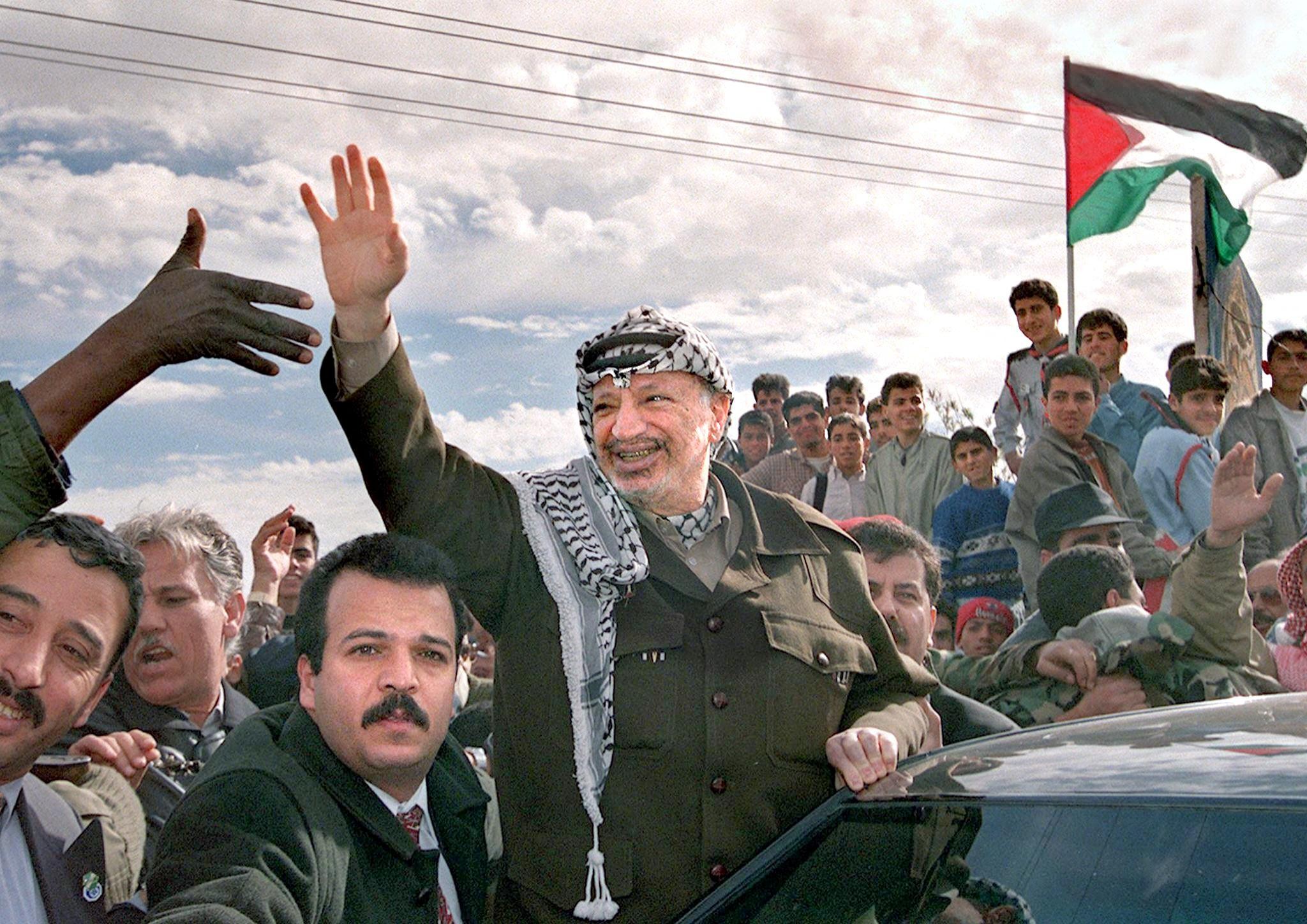
In 1994, following several rounds of negotiations, the Rafah crossing came under a form of joint control between Israel and the Palestinian Authority (PA). Israeli authorities retained most security control and could deny access to any individual.
In January 2001, however, at the time of the Second Intifada, or uprising, Israel seized full control of the crossing. Later that year, Israeli forces also destroyed Yasser Arafat International Airport in Gaza, the only airport in Palestine, which was located near Rafah.
![]()
![]()
![]() In September 2005, Israel withdrew its forces and settlers from Gaza as part of a "disengagement plan".
In September 2005, Israel withdrew its forces and settlers from Gaza as part of a "disengagement plan".
It was during that month, for around seven days, that gaps emerged in the border allowing thousands of people on the Palestinian and Egyptian sides of the Rafah border to briefly come together.
One elderly man crawled through a crack in the wall, fell to his knees and kissed the earth after touching Palestinian soil for the first time in more than three decades, according to a report from Al-Ahram.
Scores of Palestinians also left Gaza for the first time in their lives, going on day trips around Sinai.
Two months later, the Rafah crossing came back under joint Israeli and PA control until June 2007, when Hamas took control of the Gaza Strip. Since then, the crossing has been controlled by Egypt and Hamas, and is opened only intermittently.
The crossing is the only gateaway not directly controlled by Israel in and out of Gaza.
Egypt destroys its side of Rafah
There has been a long history of tunnels used by smugglers to connect the two cities of Rafah in Egypt and in Palestine.
On multiple occasions, Egypt has flooded the tunnels with both seawater and sewage, and constructed an underground barrier to stop the alleged flow of weapons, fighters and resources between Sinai and southern Gaza.
In addition to destroying tunnels, Egypt has, since 2014, effectively razed much of its city of Rafah to the ground.
Following high-profile attacks by Sinai-based Islamist militants in the Peninsula, which killed 33 Egyptian security personnel in October 2014, President Abdel Fattah el-Sisi began the process of demolishing the entire city for security reasons.
Egyptian authorities have razed 685 hectares of cultivated farmland and destroyed 800 homes as they create a buffer zone between Sinai and Gaza. All of Egypt's Rafah, home to 78,000 people, falls within the buffer zone.
The historic city and most of its villages have been destroyed. Only one village, el-Barth, whose residents are allies of the Egyptian army, remains.
Egypt is currently in the process of building a completely new Rafah city.
Ravaged by Israeli wars
Meanwhile on the Palestinian side, Rafah has been devastated by conflict in recent years.
In August 2009, in what was dubbed the Battle of Rafah, fighting between Hamas and a short-lived armed militant group known as Jund Ansar Allah resulted in 22 deaths.
The group established the Islamic Emirate of Rafah, which lasted one day - 14 August 2009 - before it was destroyed by Hamas.
Rafah has also come under Israeli bombardment during multiple wars on Gaza, including in 2009, 2012, 2014 and the present conflict.
During the 2014 war, which marked the most recent ground invasion of Gaza before the present conflict, Israel launched a huge attack on Rafah.
On 1 August 2014, after an Israeli soldier had gone missing, Israel launched air strikes and 1,000 artillery rounds on the city. Tanks and bulldozers also razed scores of homes. That assault saw 75 civilians killed in one day, including 24 children.
The Rafah offensive was reportedly an example of the use of the Hannibal Directive, an Israeli domestic rule of engagement that stipulates that if a soldier is kidnapped, then it can loosen precautions and act more aggressively.
In the present war on Gaza, despite Israel declaring Rafah a safe zone last year, the city has come under repeated Israeli bombardment. Just this week, at least 95 people, including 42 children, were killed in four Israeli attacks there, according to Amnesty International.
Aid groups and analysts have told Middle East Eye that Israel's planned ground invasion of Rafah will create a humanitarian catastrophe, and could pave the way for the ethnic cleansing of Palestinians from Gaza into Egypt's Sinai.
This article is available in French on Middle East Eye French edition.
Middle East Eye delivers independent and unrivalled coverage and analysis of the Middle East, North Africa and beyond. To learn more about republishing this content and the associated fees, please fill out this form. More about MEE can be found here.