Egypt from space: Satellite views of the pyramids, Nile, Cairo and Suez
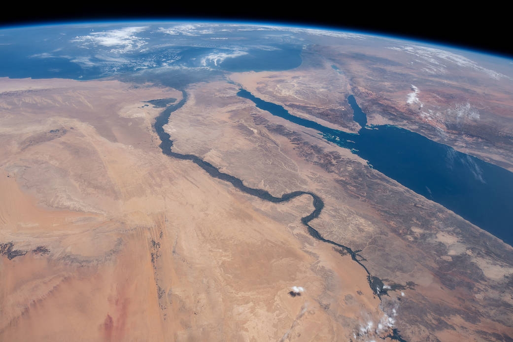
This photograph, taken from about 400km above Earth, is dominated by Egypt, including the river Nile and the Sinai, the Red Sea and the Mediterranean. The coast of Saudi Arabia is to the right, Israel, Jordan and Syria further north. The image was taken from the International Space Station (ISS) on 10 June 2019 (Nasa)

From above Egypt, this night-time shot shows the country's urbanisation, concentrated along the Nile. The large light patch at the base of the Nile delta (the inverted triangle) is Cairo; to the west of the Nile, below, is the Faiyum Governorate. Alexandria is the line of light on the western coast, beneath the cloud-covered Mediterranean. Further down the coast to the east is Gaza and, inland from there, Jerusalem. Taken by the ISS on 28 October 2010 (Nasa)
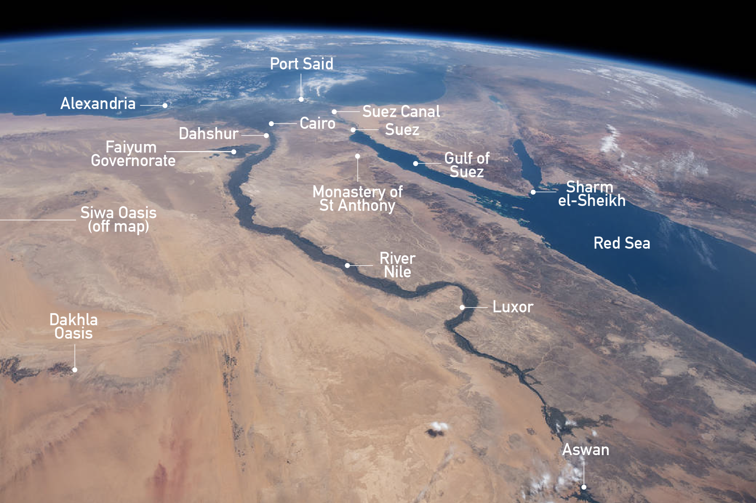
This image has been taken at an angle from the ISS and so it's not possible to add a scale. As a guide, the road distance from Cairo to Luxor is 504km; from Cairo to Alexandria it's around 220km, and from Luxor to Aswan it's around 230km (Nasa)
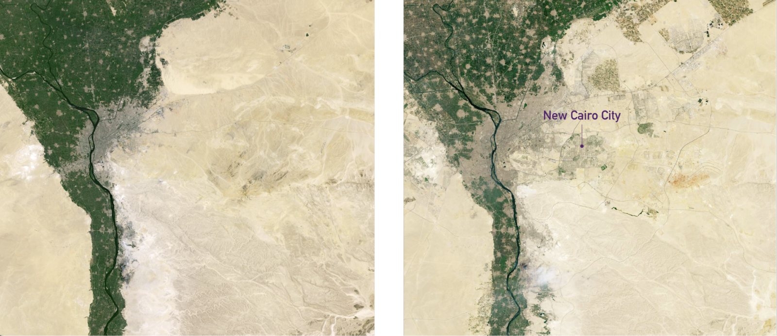
Between 1950 and 2020, the population of Cairo rose from 2.5m to more than 21m, reflecting its status as the largest Arab city in the Middle East. From space, the change is obvious. The image on the left was taken in July 1984 through the Landsat 5 satellite, and the second in September 2019 with Landsat 9. Urban development is shaded grey, desert areas are beige and farmland green. Note the expansion, not least on the eastern side of the Nile. Of special note is New Cairo in the centre of the right-hand image, designated a city by presidential order in 2000. Opposite this is Giza, a city in itself (Nasa)
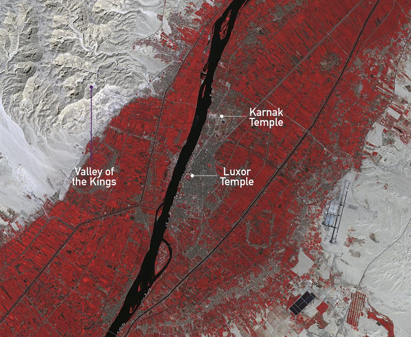
This false-colour image shows the city of Luxor, which is located 504km south of Cairo on the river Nile, and the site of the ancient Egyptian city of Waset. To aid identification, water is shown as black, vegetation is red, and urban areas are brown to grey. Known to the ancient Greeks as Thebes, Waset includes the temple complexes at Karnak and Luxor. To the north is the Valley of the Kings, the burial place of dozens of Egypt's pharaohs, including King Tutankhamun. Taken on 15 November 2018 from the Terra satellite, using data acquired from Nasa/Meti/AIST/Japan Space Systems (Nasa/JPL)
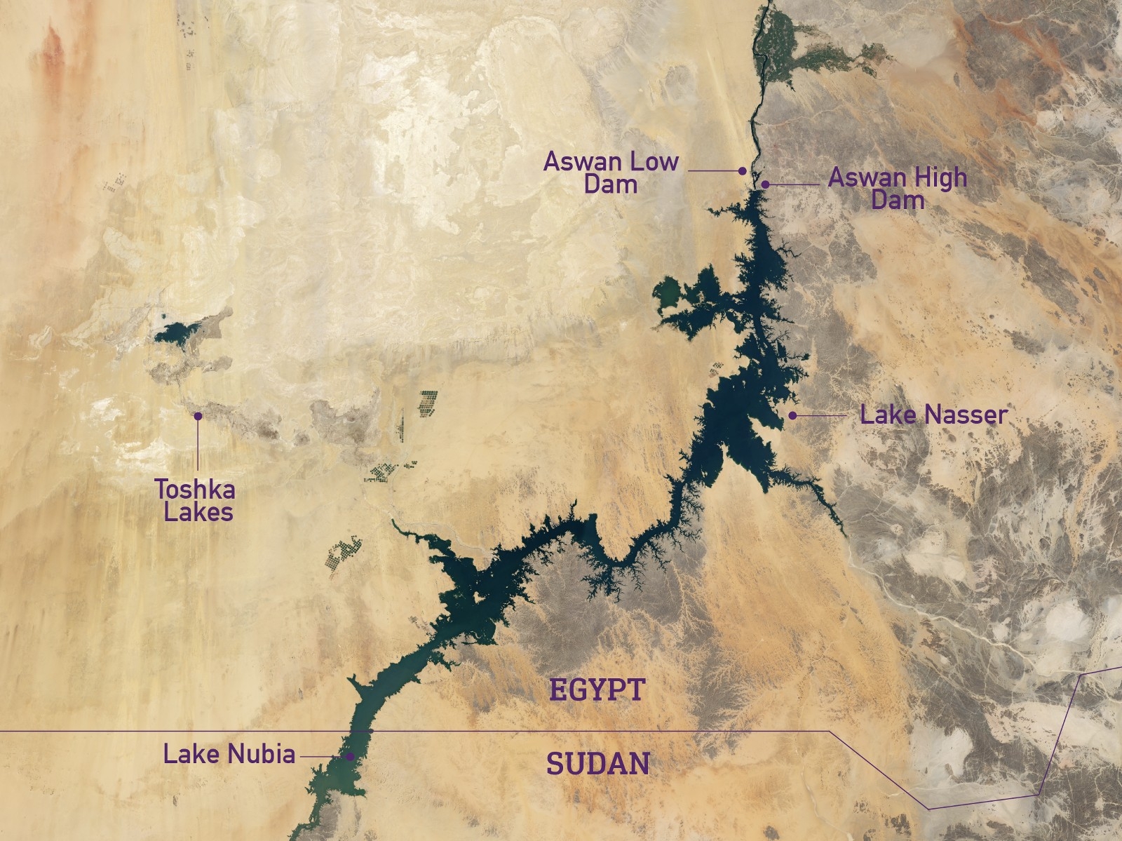
The man-made Lake Nasser was named after the then-Egyptian president and was created following the decade-long construction of the Aswan High Dam. The dam began operating in 1970, 68 years after the smaller Aswan Low Dam downriver. The lake is 479km long, 16km wide, and took six years to fill. As a result of its construction, Egypt increased its arable land by one-third. It also attracts fishermen and tourists.
However, lake levels are threatened by the Grand Ethiopian Renaissance Dam to the south, which opened in 2020 and is a cause of tension between the two states. Lake Nubia is the smaller body of water to the south, in Sudan. The Toshka lakes emerged during the 1990s as a result of overflow from Lake Nasser. The composite image here was taken between 2013 and 2020 with Landsat 8 (Nasa)
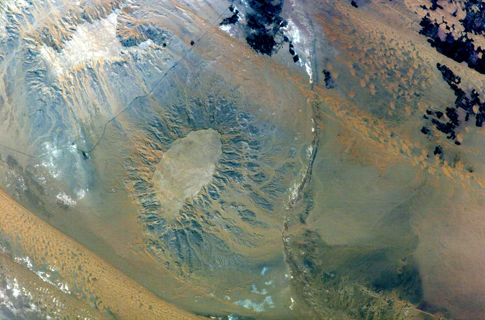
The Dakhla Oasis, 750km from Cairo, has been a key crossroads for trade between Egypt and Sudan for centuries. The Gebel Edmonstone, which overlooks this part of the Western Desert, is a "mesa" (steep, flat-topped hill or ridge) made from chalky limestone, underneath which lies shale containing fossils and sedimentary rock. This image has been enhanced to contrast the region's geology, including the limestone (white-grey) and sediment (blue-grey). Vegetation, which is mostly fields for farming, is to the north and coloured dark blue-black. Taken from the ISS on 18 June 2004 (Nasa/JSC)
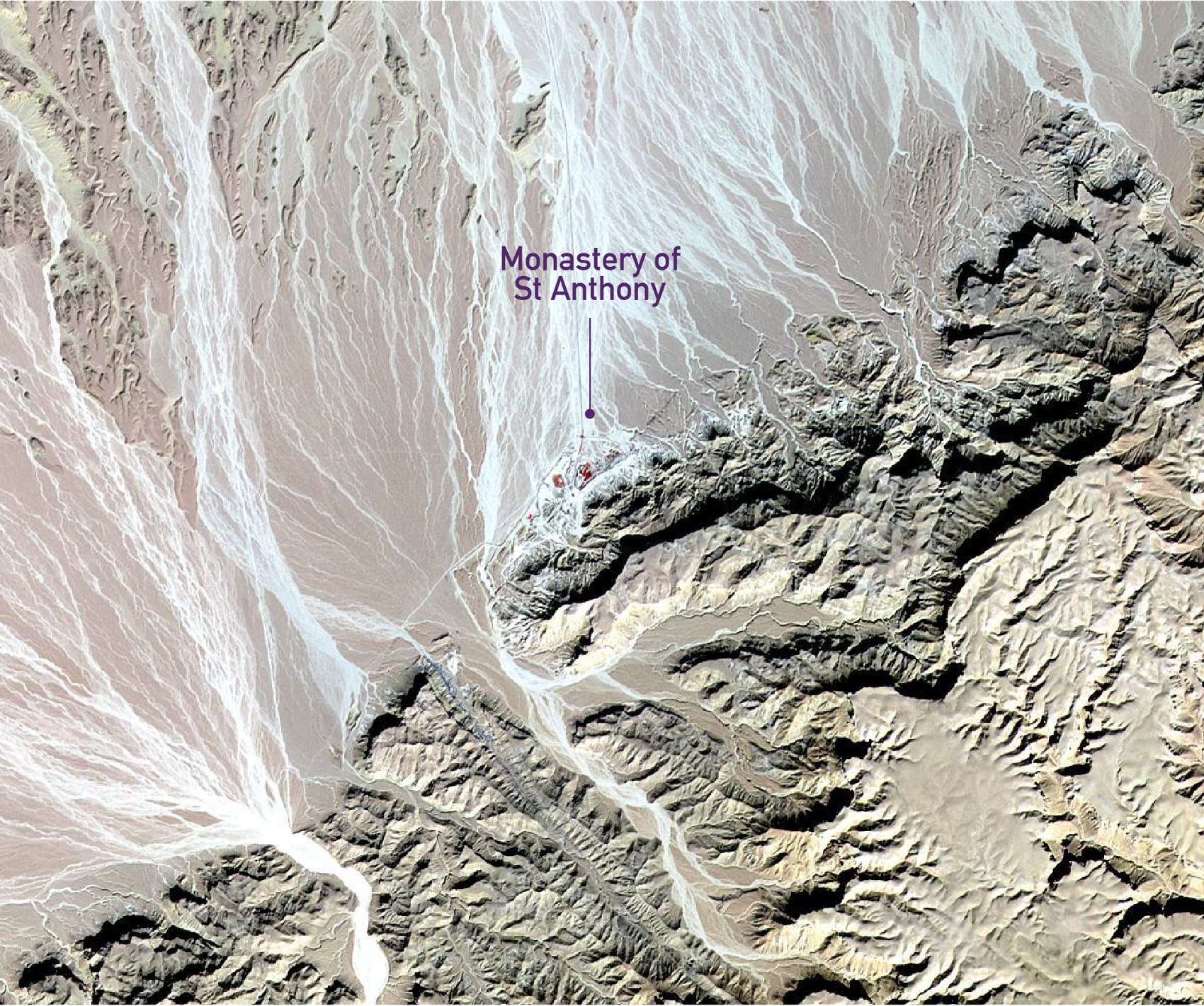
Bare plains meet hilly uplands in this false-colour image, taken around 200km southeast of Cairo and 30km west of the Gulf of Suez. To the northwest of the hills are alluvial fans, formed when rivers stream from high terrain and flow quickly onto flat land. The bare rock is coloured from pink-beige to tan, vegetation appears red, and the fans are the wavy lines of blue-grey and white flowing down from the uplands. Dwarfed by this harsh landscape is the Coptic Christian Monastery of St Anthony, which dates back to 300CE and is situated on an oasis, whose vegetation is coloured red here. Taken by the Terra satellite on 13 November 2009 (Nasa/Aster Science Team/JPL)
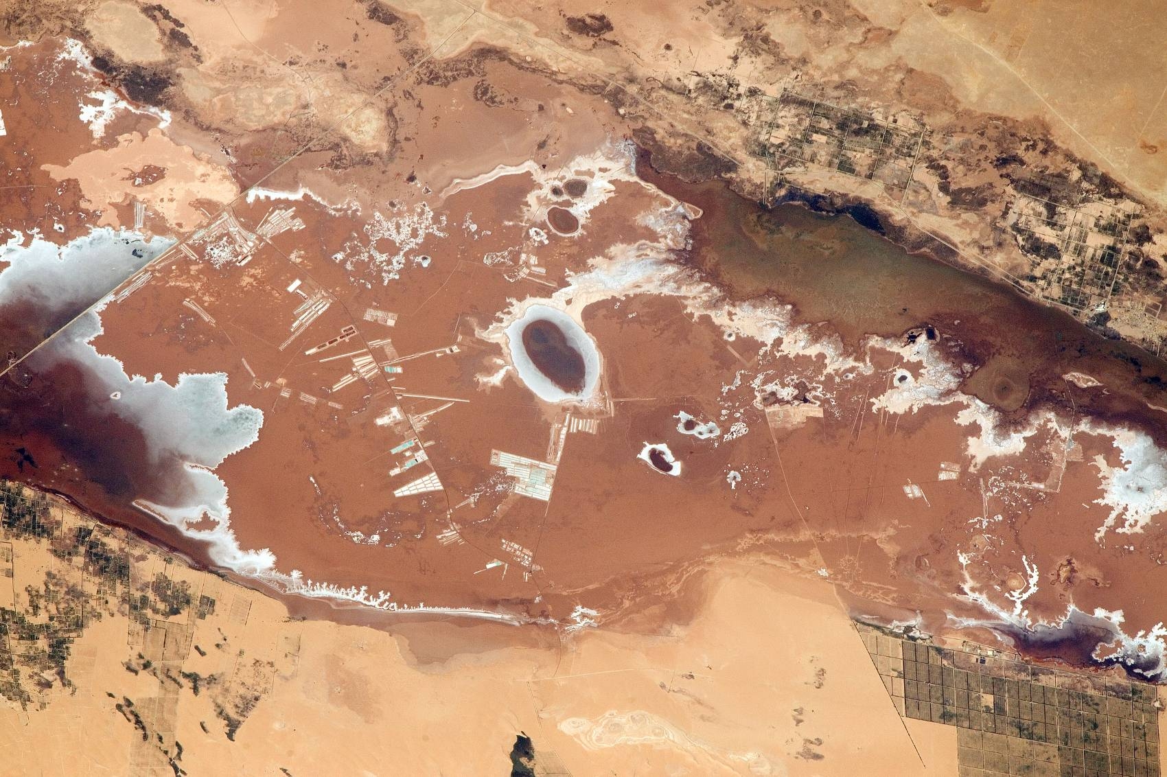
The Siwa Oasis in northwest Egypt is 20 metres below sea level and around 50km from the border with Libya. The secluded region has been inhabited for at least 12,000 years, thanks to groundwater-supporting vegetation. Visitors during ancient times included Alexander the Great, during the fourth century BCE. The area has traditionally been renowned for its salt pools and salt production, as well as, more recently, upmarket tourism. To the east is the Qattara Depression, and to the west is the Great Sand Sea, bigger in area than Lebanon, Qatar and Bahrain combined. Taken from the ISS on 8 May 2015 (Nasa)
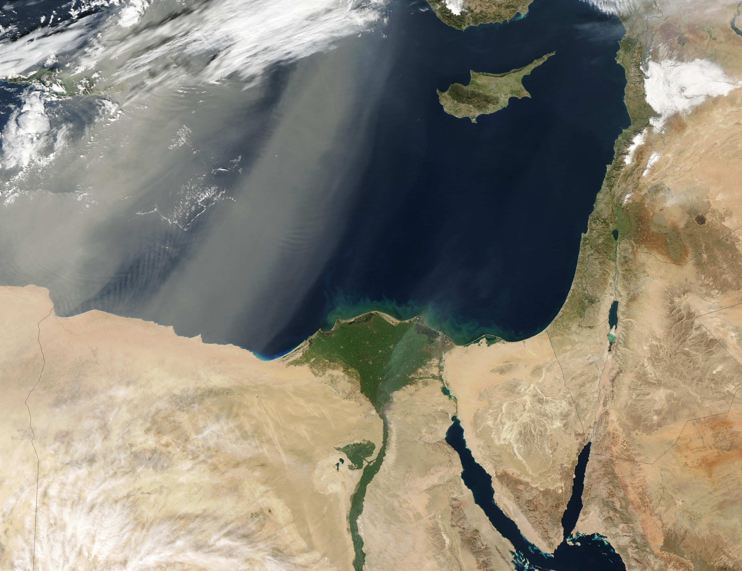
Fierce winds have eroded and shaped Egypt for centuries. Seen here, thick gusts of desert dust blow across the west of the country into eastern Libya, before shading the Mediterranean and concealing the island of Crete (top left). Cyprus, to the east, is unaffected. Taken by Aqua, a sister satellite to Terra, on 12 January 2003 (Nasa)
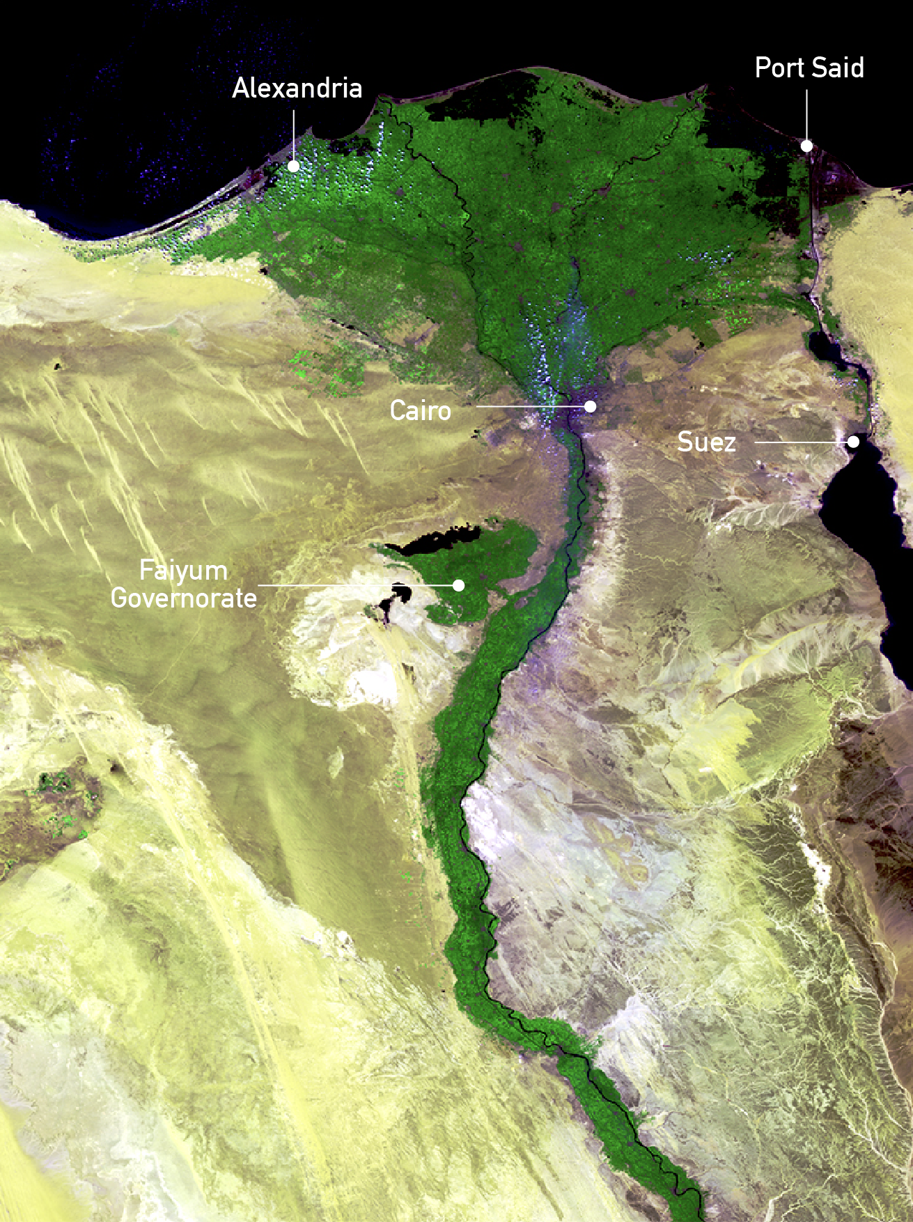
The river Nile is vital to the lives of millions of Egyptians. Satellite photography across the country starkly contrasts desert-hued plains and fertile vegetation fed by the river's waters. The world's longest river begins life as two separate tributaries outside Egypt's borders: the White Nile (the source, situated in Uganda) and the Blue Nile, which begins in Ethiopia and carries the bulk of the water. In this image of northern Egypt there is more green to the west of the river, where flatter land is easier to irrigate than the rugged hillsides to the east. Taken by the Proba-V satellite on 24 March 2014. (ESA)
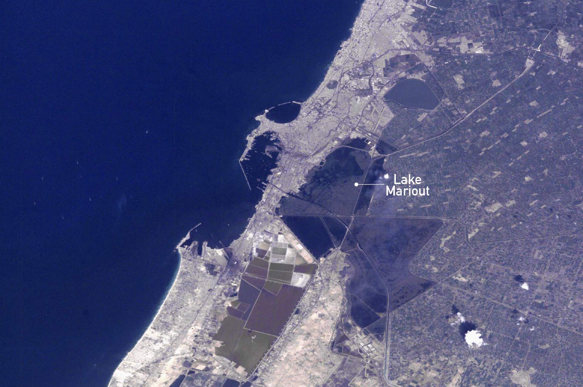
Alexandria was founded by Alexander the Great in BCE331 and was the capital of Egypt until the seventh century. It is the country's second-largest city, its largest port, and a haven of ancient learning and culture. But now, climate change and rising sea levels mean that water is encroaching on the area from the Mediterranean to the north and the Nile Delta to the south. Lake Mariout is the large fuzz of blue-grey seen close to the port. The smaller green and brown shapes below are sites for salt evaporation, chemical storage and water treatment. The flecks in the port and Mediterranean are ships and tankers. Taken by the ISS on 31 December 2000 (Nasa/JSC)
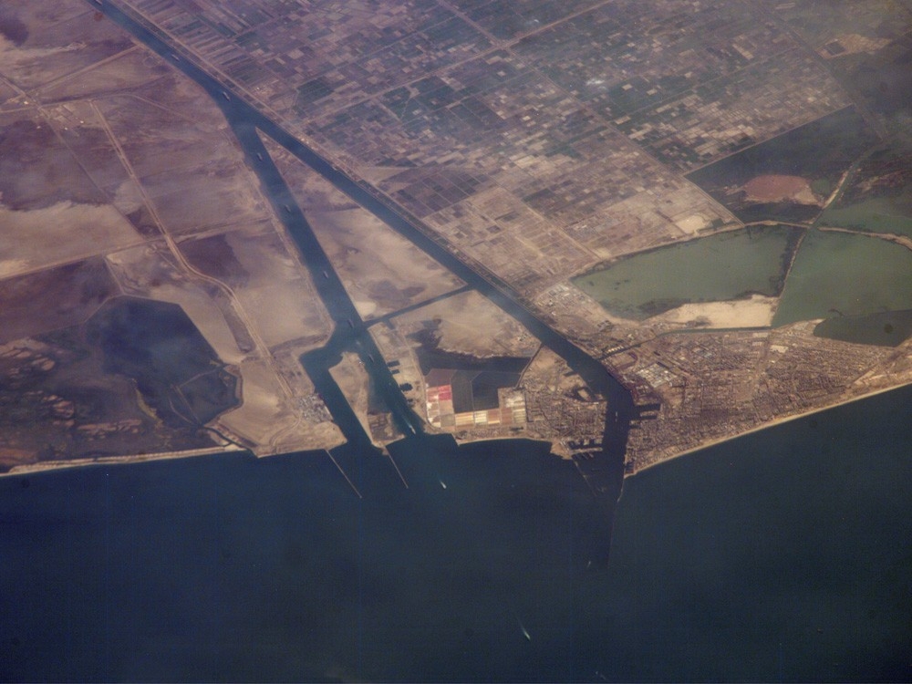
The construction of the Suez Canal, which opened in 1869, was one of the greatest engineering projects of the 19th century, linking Port Said (here on the right) on the Mediterranean coast with the port of Suez on the Red Sea, and providing an essential route for transport between Europe and Asia. More than 190km long, it has been controlled at various times by Egypt, the UK, France and the UN. It is currently overseen by the state-owned Suez Canal Authority (SCA) and takes around 14 hours to navigate. This image of the northern entrance was taken by the ISS on 30 June 2006 (Nasa)

This image of the Suez Canal has been rotated anti-clockwise to better illustrate the extension, which opened in 2015. The left side is towards the north and the Mediterranean, while the south, including the port of Suez, is on the right. The body of water in the middle is the Great Bitter Lake, one of the canal's holding and passing areas. It was here in February 1945 that President Franklin Roosevelt and King Abdulaziz Al Saud of Saudi Arabia struck a deal aboard the USS Quincy: the US would provide military support to Riyadh in return for secure oil supplies. The canal closed for eight years after 1967 due to the Arab-Israeli War. This meant that 14 cargo vessels and their crews heading north were stranded in the lake and became known as the Yellow Fleet due to the desert sand coating the ships. Image taken 15 April 2016 by Landsat 8 (Nasa)
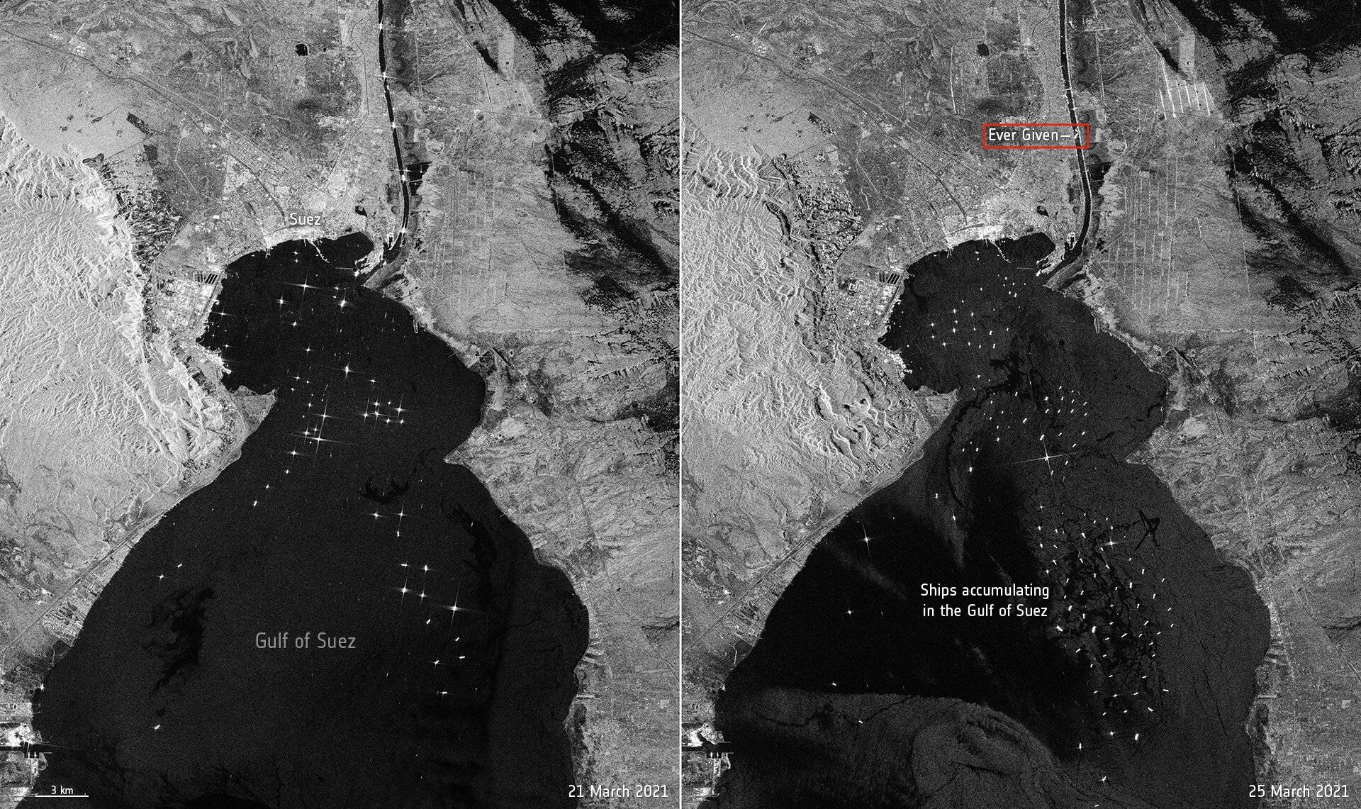
In late March 2021, the 400m-long container ship Ever Given grounded in the Suez Canal just north of Suez, blocking one of the world’s major trade routes. The image on the left, taken on 21 March, shows the usual pattern of maritime traffic on the canal. The one on the right, taken four days later, shows the 200,000-tonne tanker aground, with other vessels backed up as a result on the canal’s southerly approach (delayed vessels could not use the Great Bitter Lake or the newly opened bypass to evade the boat). Taken by the Copernicus Sentinel-1 mission 2021 (ESA)
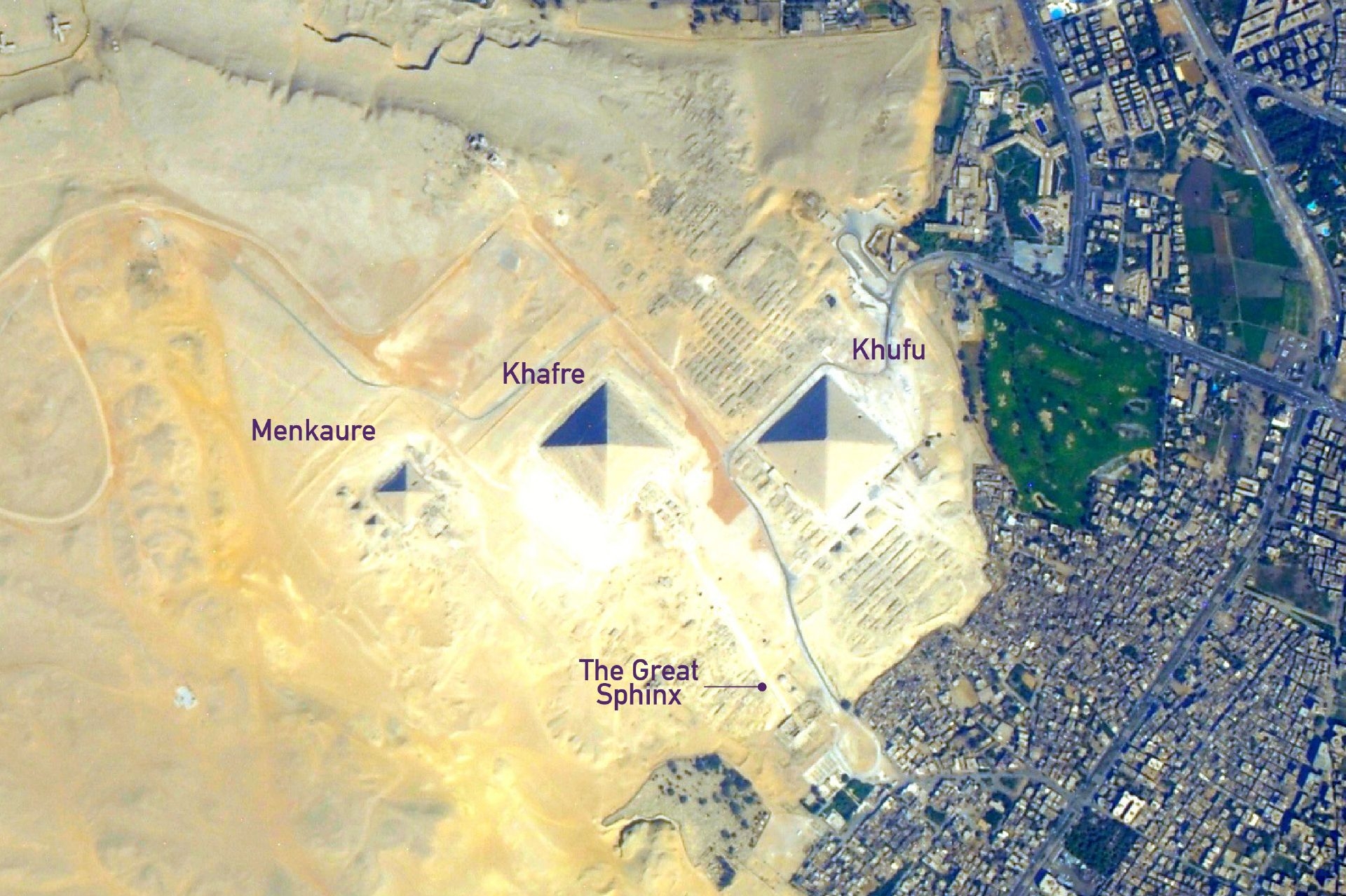
Giza is home to Egypt’s most visited pyramids, built around 4,500 years ago in honour of the pharaohs Menkaure, his father Khafre, and his grandfather, Khufu. The Great Pyramid is the only surviving Wonder of the Ancient World. Nearby are smaller, unfinished pyramids and tombs reserved for key officials. The Great Sphinx is to the southeast of the middle pyramid. The site is next to modern Cairo and includes a golf course whose footprint is bigger than that of the adjacent Great Pyramid. Taken by the ISS on 25 July 2012 (Nasa/JSC)
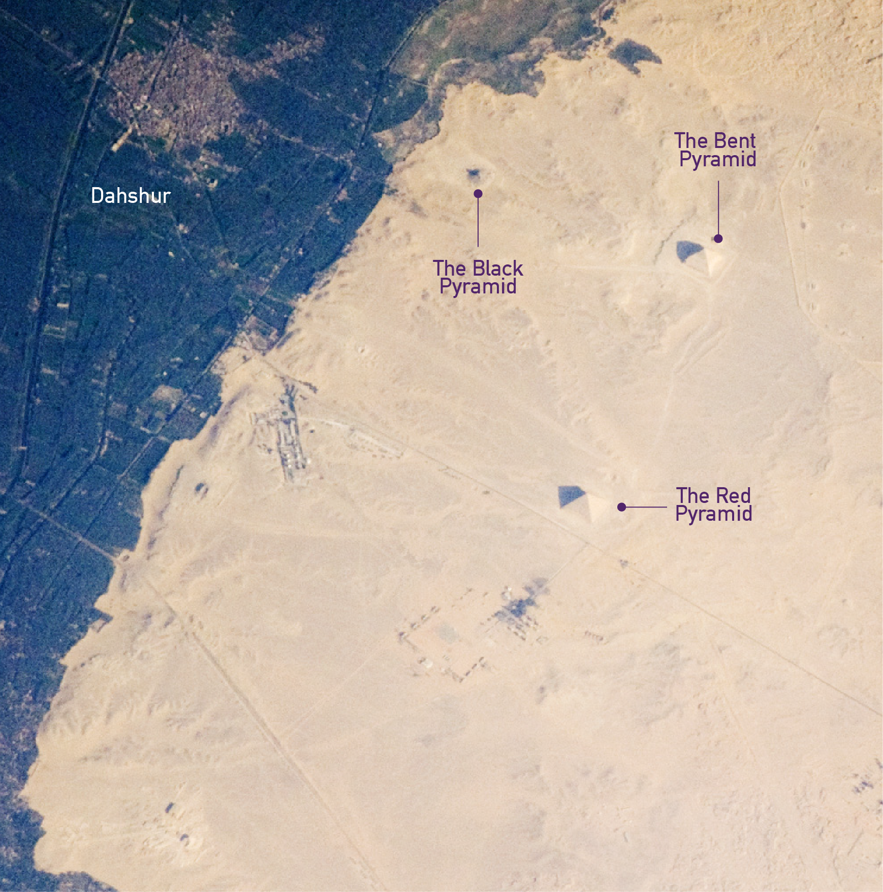
Near the village of Dahshur, 20km south of Giza and close to the Nile, sit the Red and Bent Pyramids, both built during the reign of the Pharaoh Snofru (BCE2613-2589). Their condition has deteriorated over the millennia, due to the elements and the removal of outer protective blocks. The Bent Pyramid is named after the way its angle lessens halfway up. The more recent Red Pyramid is so-called due to the building stone at its core. The nearby Black Pyramid, which was built around 700 years later, has a crumbling edifice and mound-like appearance. Taken by the ISS on 30 May 2008 (Nasa/JSC)

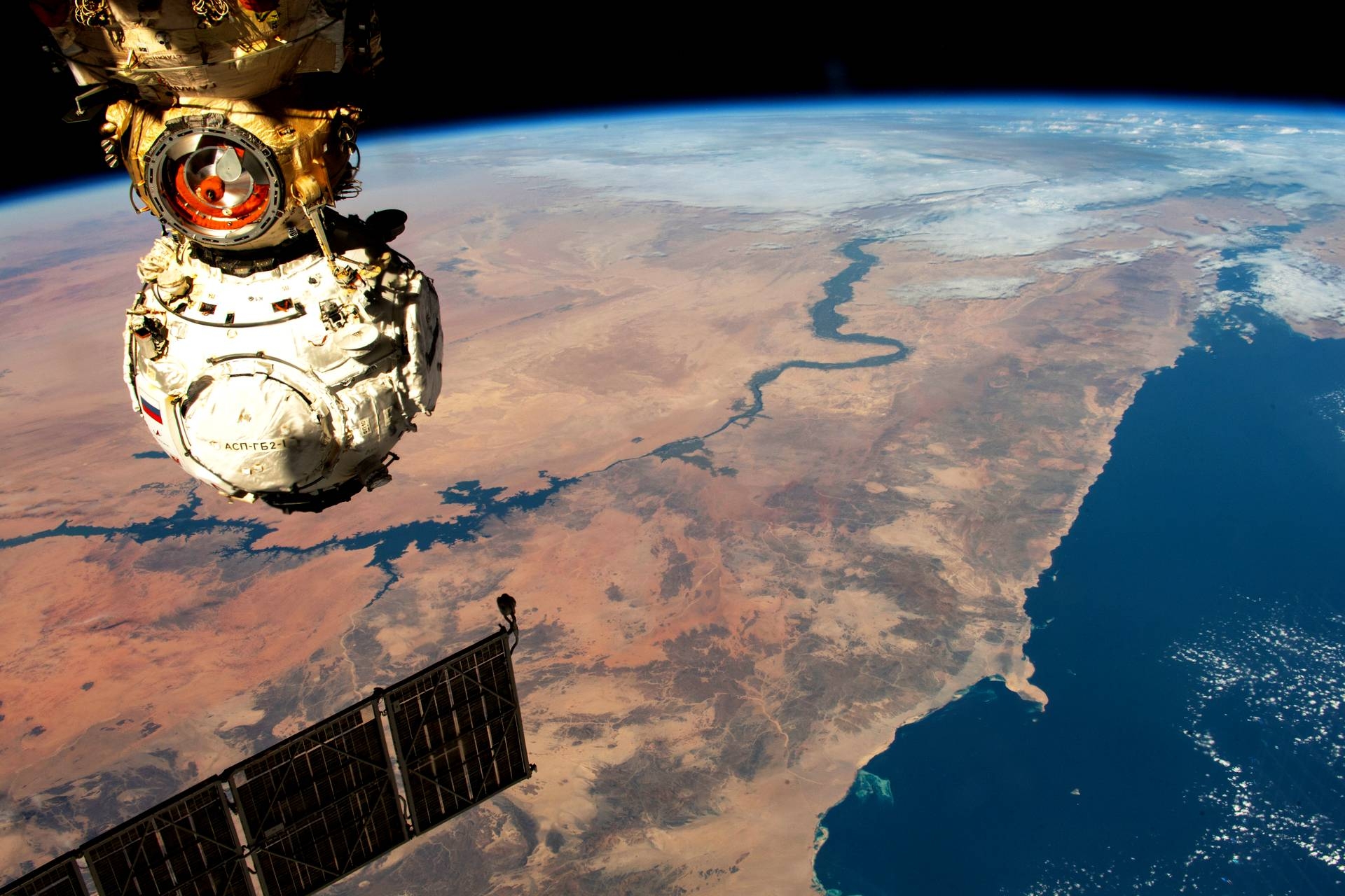
German ESA astronaut Matthias Maurer captured this shot of the Nile and the Red Sea coastline while flying over Egypt on board the ISS. The city of Luxor sits on the lower part of the central bend in the Nile: further south is the Aswan Dam and Lake Nasser. The hardware that dominates the image is the Russian Prichal module, which was launched on 24 November 2021. It weighs four tonnes and has six hybrid ports. Taken on 14 February 2022 from the ISS (ESA/Nasa)
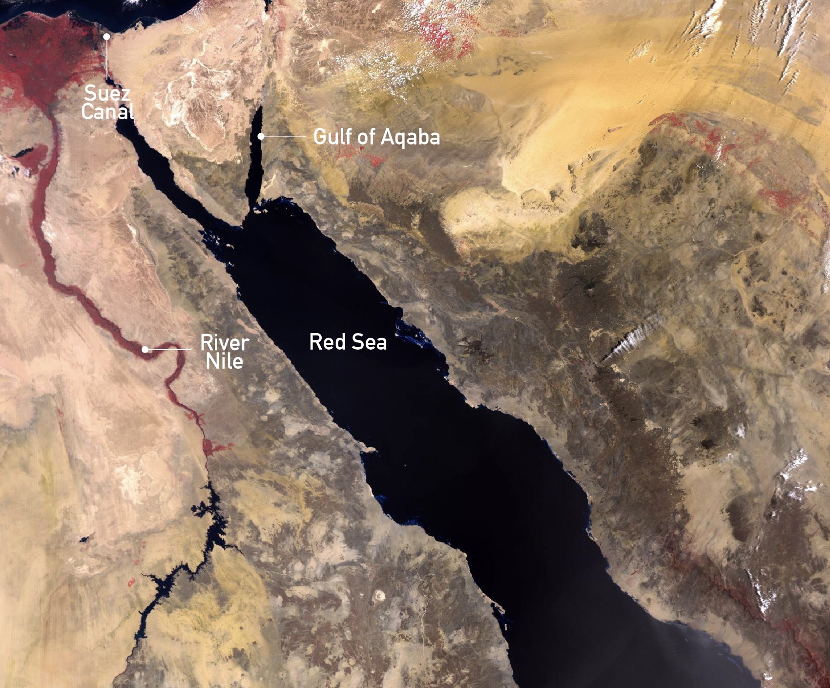
This photo, taken with a radiometer to measure radiant energy, shows the east coast of Egypt on the left, joined to the Arabian Peninsula (right) by the inverted triangle that is the Sinai peninsula. Between them lies the Red Sea, formed when the African and Arabian geological plates tore apart millions of years ago. The sea is one of the world’s saltiest and warmest large bodies of water: no rivers flow into it and there is little, if any, rainfall. It is also hard to navigate, due to few natural harbours and, in the south, coral reefs. Taken on 9 May 2018 with the Sentinel 3B satellite (ESA)
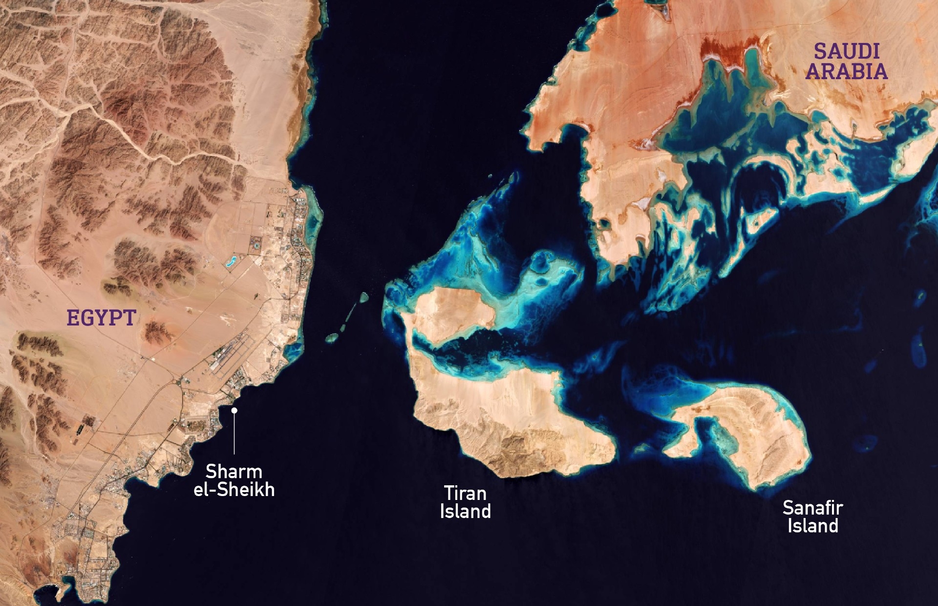
Sharm el-Sheikh borders the warm waters of the Red Sea at the southern tip of the Sinai: note the urbanised coastline on the left. The resort, which hosted the Cop27 environmental summit in November 2022, is famed for its clear waters and coral reefs, although in recent years these have been damaged through over-exploitation. Sometimes the waters turn shades of red and brown due to natural algae blooms. The top-right of the image is the western tip of Saudi Arabia: the red colour represents higher levels of moisture, and the white represents salt. In 2016 Egypt ceded the long-disputed islands of Tiran and Sanafir (centre) to Saudi Arabia. Taken on 11 April 2017 by Copernicus Sentinel-2 (ESA)
Both Nasa and the ESA regularly publish photography relating to space exploration on their respective digital platforms.
This article is available in French on Middle East Eye French edition.
Middle East Eye delivers independent and unrivalled coverage and analysis of the Middle East, North Africa and beyond. To learn more about republishing this content and the associated fees, please fill out this form. More about MEE can be found here.


