In pictures: Palestinian villages before the Nakba
In the run-up to the establishment of Israel, the Zionist movement acquired Palestinian land for use in the new state, initially by purchase and later by the use of force. In the majority of cases, particularly during the year leading up to the Israeli declaration of independence, this process of acquiring land involved the expulsion of indigenous Palestinians. In some cases, the villages where these people lived were settled by new Jewish migrants and in others they were razed and built over. This photo essay explores some of the historically significant villages throughout districts of Palestine before the Nakba.
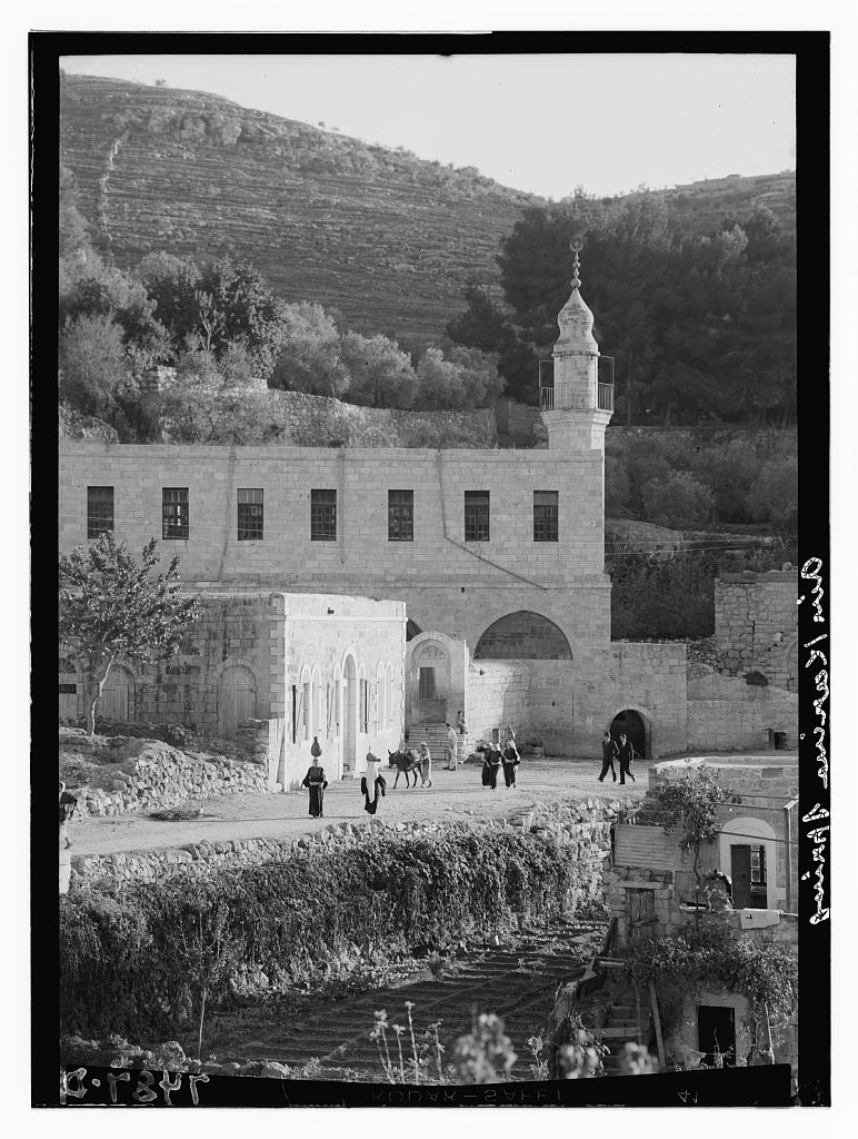
It is widely believed that John the Baptist was born in Ayn Karim and the village therefore has a biblical importance. The Church of John the Baptist is one of the village's main attractions and a site for pilgrimage. Ayn Karim also had a mosque named after Umar Ibn Khattab, the second Muslim caliph, after he passed through village and prayed there during the Muslim conquest of Jerusalem in the 7th century.
The picture above is of Ayn Karim in 1934 when it was the largest village in the Jerusalem district and home to more than 3,000 Palestinians, a mix of Muslim and Christian families. (Library of Congress)
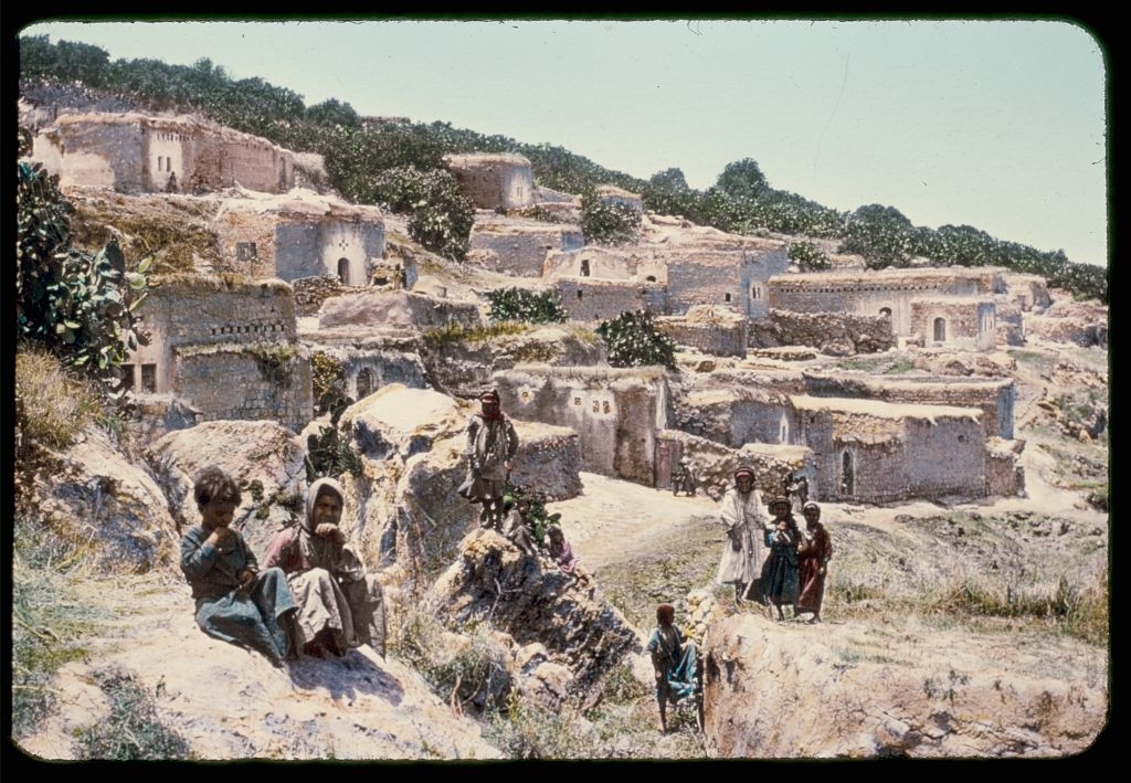
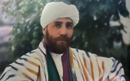
Indur was a Palestinian village in the Nazareth district that was home to over 600 Palestine before 1948. The village has ancient roots in biblical times and its name likely derives from the Canaanite town of Ayn Dur, mentioned in the Bible as the site where Saul consulted a soothsayer before going into battle against the Philistines. Indur was home to Shaykh Tawfiq Ibrahim, one of the leaders of the Palestinian revolt between 1936 and 1939. (Library of Congress)
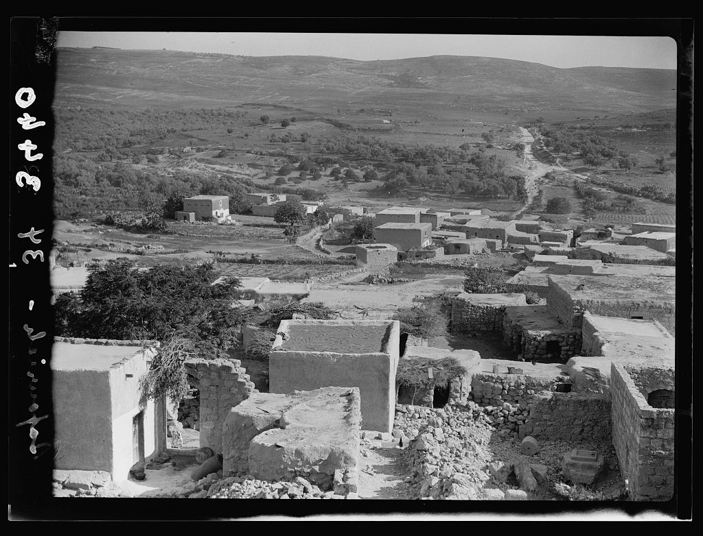
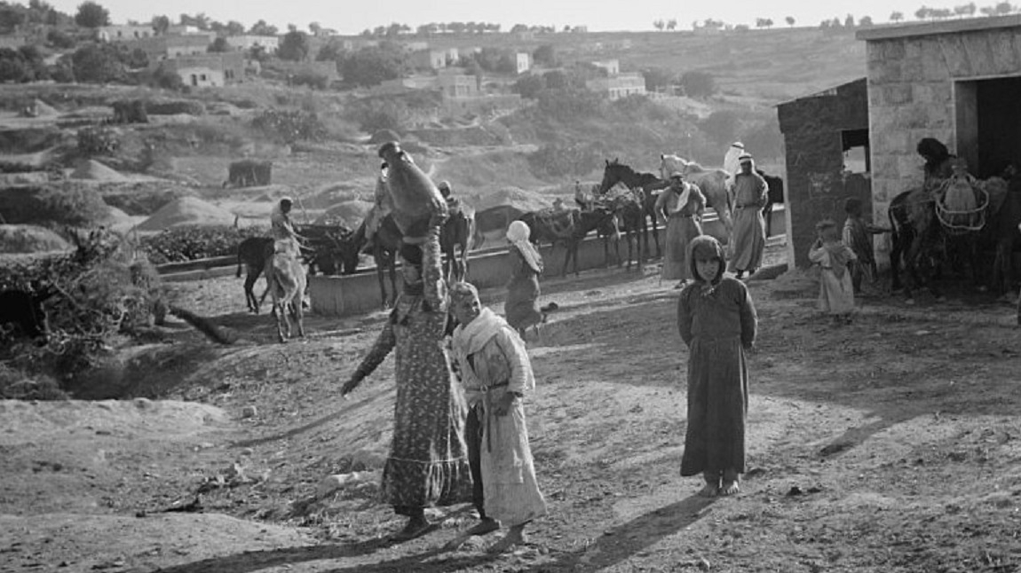
Saffuriya was home to over 4,000 Palestinians and was a village perched on a hill on the outskirts of Nazareth and the lower Galilee. Saffuriya has held strategic significance since ancient times. During the Roman conquest of Palestine, it became the administrative centre for the Galilee region. The Crusaders built a castle in Saffuriya, which Saladin would later claim during his conquest of Palestine. Many prominent Islamic scholars such as Ibn al-Imad al-Hanbali made references to Saffuriya, exemplifying its revered status. The image above, as well as the one at the top of this photo essay, were taken in Saffuriya. (Both images are from the Library of Congress)
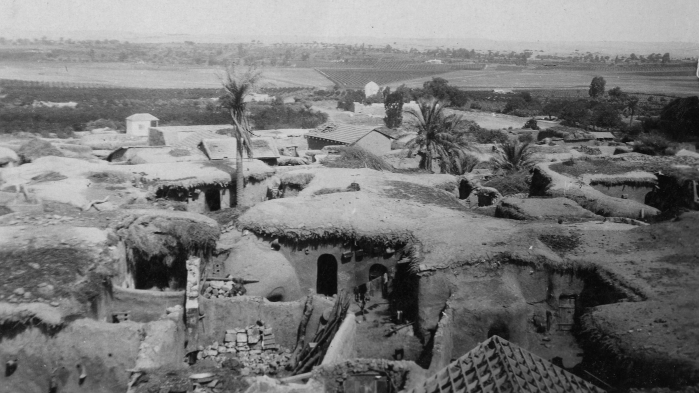
Yibna was a large village built of stone and situated on a hill approximately 15 kilometres from al-Ramle. The village of Yibna has a deep history that stems from ancient times and has been described by many Arab geographers and chroniclers as one of the most ancient cities in Palestine. Before 1948, Yibna was home to over 5,400 Palestinians. The image above depicts Yibna between 1914 and 1916. (Israeli National Library)
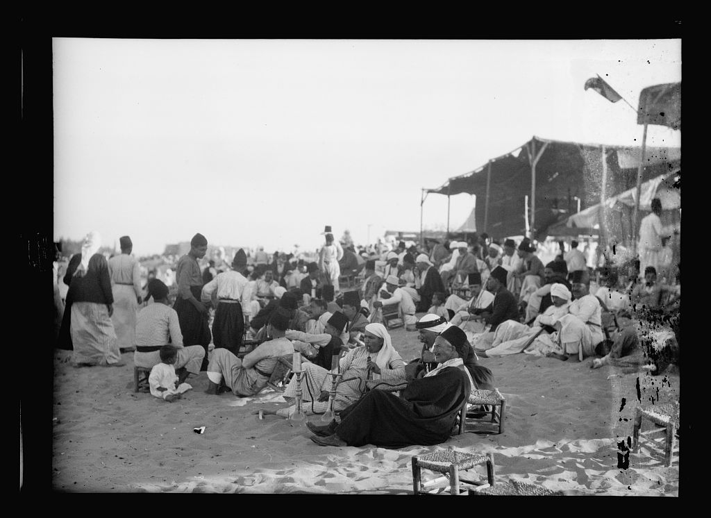
One of the most important historic villages in Palestine was al-Nabi Rubin. This village was located on the site of a shrine of the prophet Jacob's son, Reuben. The shrine was honoured with an annual pilgrimage in Palestine, during which large celebrations were held and Palestinians from surrounding areas would flock to the village to take part in the celebrations.
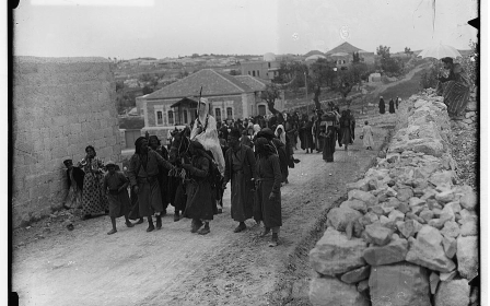
These would entail dabka, magic shows, horse races, popular songs, and sermons by preachers and poets. The pilgrims would camp in tents, and throughout the village makeshift cafes, restaurants and shops were set up for them. The village served as an important historic, religious, and cultural site for Palestinians, as the Nabi Rubin pilgrimage was one of the most important annual events in Palestine. The picture above, dated 1930, depicts pilgrims in al-Nabi Rubin. (Library of Congress)
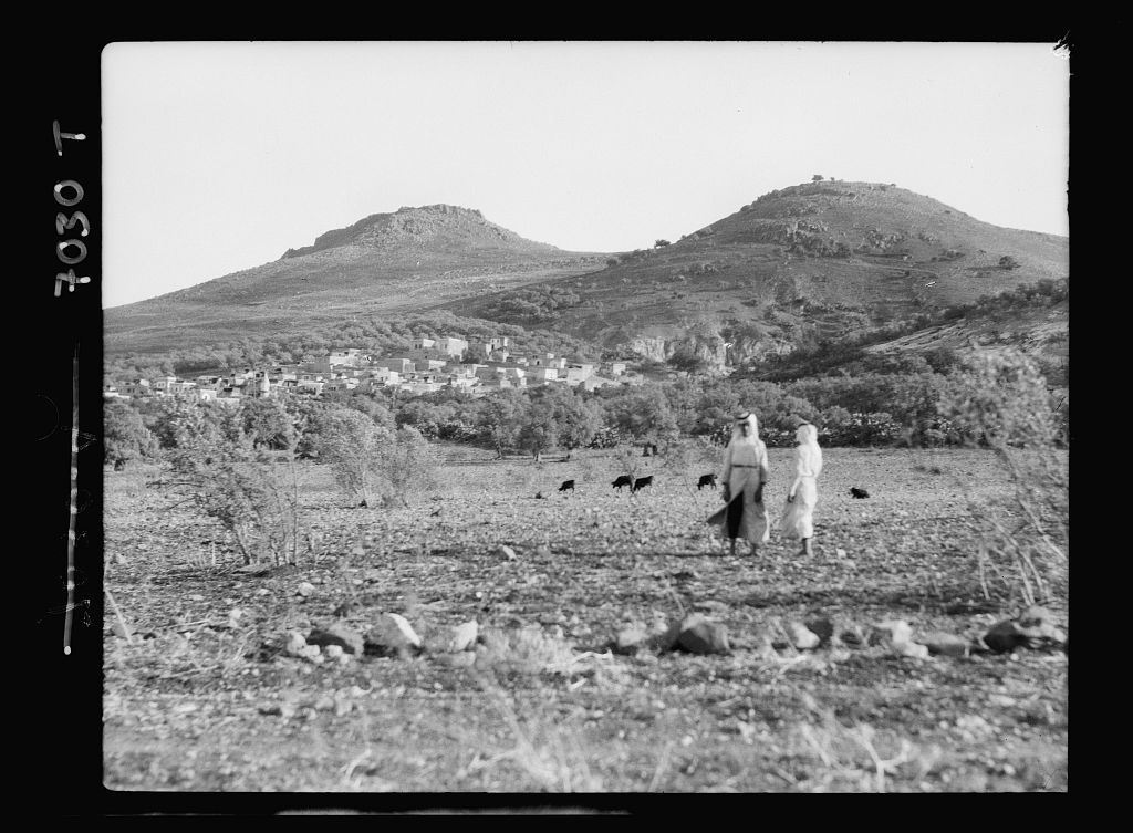
Hattin was located on the outskirts of Tiberias. The area's history is rich and it is most famous for the Battle of Hattin in 1187, in which Saladin defeated the Crusader armies and secured the entire region of Galilee. One of its most significant landmarks is the shrine of the Prophet Shuayb which was sacred for people of the Druze faith, who made a pilgrimage to the site each year. The picture above shows the area around Hattin in 1934. (Library of Congress)
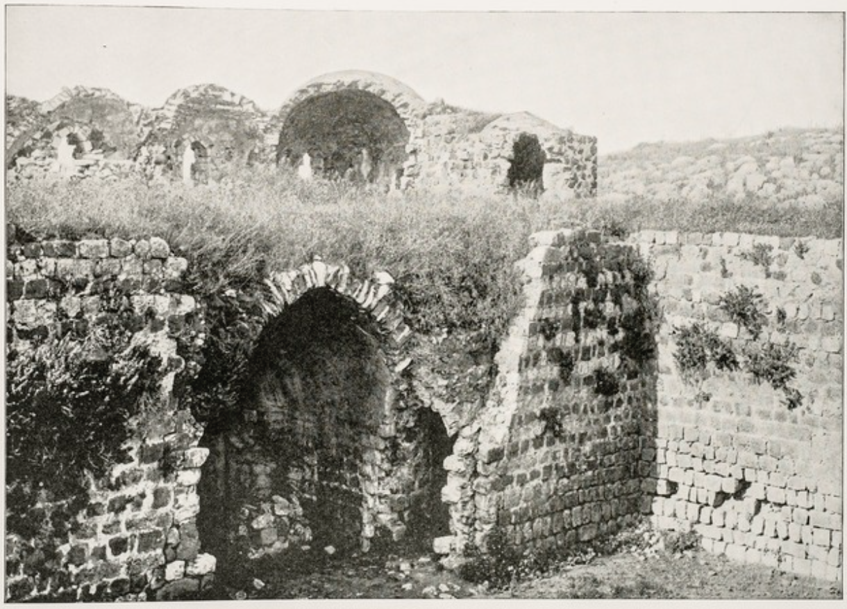
Qaqun is a Palestinian village situated just 6km from Tulkarm. It is considered an important historical site as a Crusader fortress was built on its land, in addition to a Mamluk mosque that could be seen from a distance. The picture above depicts Qaqun in 1911. (Ariel Publishing House)
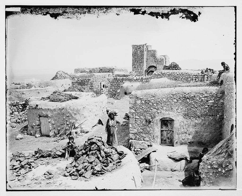
Zirin, pictured here in 1900, is a Palestinian village 11km north of Jenin. The village is also the hometown of the leader of the 1936 revolt, Mahmud Salim. Zirin was a humble village that was home to over 1,400 Palestinians. Its homes were built of mud, and the village had a small marketplace, an Ottoman school, and a small mosque. The site is historically significant and contains various artefacts from medieval times. (Library of Congress)
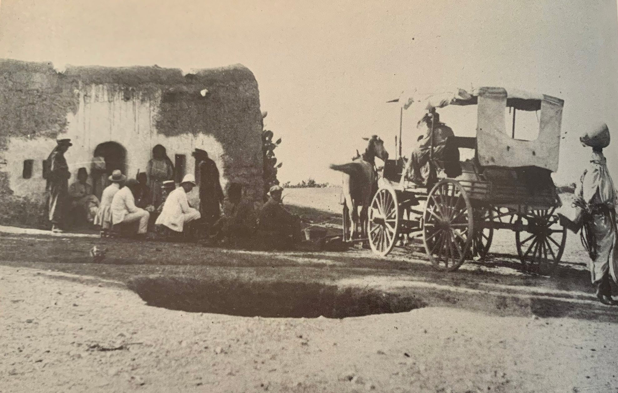
Jubb Yusuf village was also historically significant and known as a stopping point for Arab and western travellers. Pictured above are the historic travel lodges of the village. It is noted that Saladin stopped there en route to fight the Crusaders at the Battle of Hattin. The village is also situated next to Joseph's Well, which is where it likely acquired its name. The small village was home to almost 200 Palestinians in 1948. (Israeli National Library)
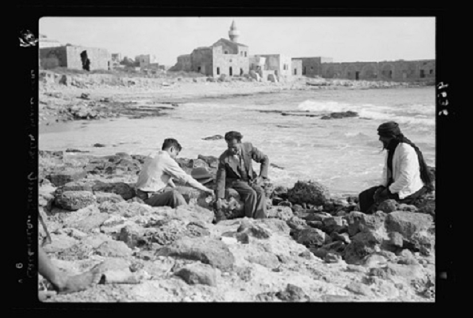
Qisarya is the Arabised form of Caesarea, the ancient city of Caesarea Maritima built by Herod the Great. In 1884 Bosniak Muslims settled in the ancient city and established a small fishing village after fleeing from the Austro-Hungarian occupation of Bosnia and Herzegovina in 1878. The picture above was taken in 1938. (Library of Congress)
This article is available in French on Middle East Eye French edition.
Middle East Eye propose une couverture et une analyse indépendantes et incomparables du Moyen-Orient, de l’Afrique du Nord et d’autres régions du monde. Pour en savoir plus sur la reprise de ce contenu et les frais qui s’appliquent, veuillez remplir ce formulaire [en anglais]. Pour en savoir plus sur MEE, cliquez ici [en anglais].


